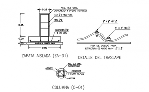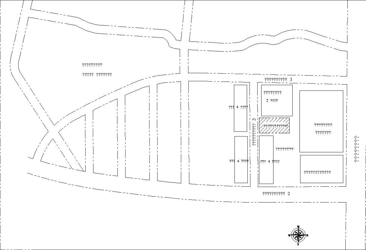
This Architectural Drawing is AutoCAD 2d drawing of Site Location details in 2d AutoCAD, dwg file. Site location map means a representation by means of signs and symbols on a planar surface, at an established scale, of the streets, wells, and general use of the land for properties within at least one-quarter mile of the facility boundaries, with the direction of orientation indicated.